| サイト名 | 「左々丘」 ZoZo Hill |
| 経度 Long. | 32:10:30 N |
| 緯度 Alt. | 80:56:21 E |
| 標高 Height | 4619m |
| 「左々丘」 [ ZoZo Hill ] 経度32:10:30 N, 緯度80:56:21 E、標高4619m | |
|
|
|
|
|
|
|
Merit on ZoZo Hill "左々丘"の利点 | ||
| 1 |
expected calm wind conditions , as the site(4619m) is surrounded by higher mountains. ZoZo Hill(4619m) は、周辺が5000m以上の山に囲まれているので風は穏やかと推定される。 | |
| 2 |
Sky clearness is expected according to WRF (Weather Research and Forcasting) simulation. 晴天率はWRF (Weather Research and Forcasting)シミュレーションから65%と推定される。 | |
| 3 |
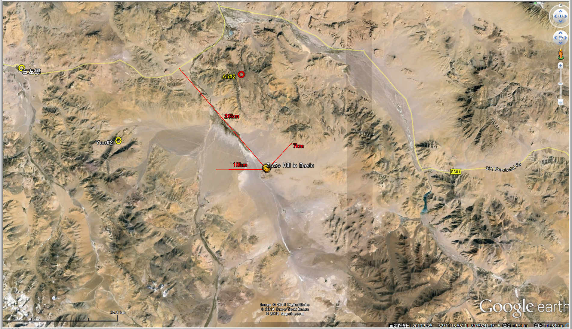
easy access to the site as available public road, S301, about 100km from ShiquanheSouth (Ali). 周辺の中心都市獅泉河(アリ)からはS301道路で100kmで到達できる。 | |
| 4 |
no city light is observed, as ShiquanheSouth (Ali, 獅泉河) cannot be seen due to the mountains. 周辺に山があるので都市光の影響はない。 | |
| 5 |
samll hill supplies the firm base for the Telescopes. 小山であるので望遠鏡の土台として強度のある岩盤が利用できるだろう。 | |
| 6 |
Site area is wider than Mauna Kea Summit. ZoZo Hillの面積は、マウナケア山頂の約2倍スケール(面積で4倍)である。 | |
| 7 |
Surrounding area supplies the area for other astronomical telescopes, such as radio telescope and Cherenkov telescopes. ZoZo Hill周辺の盆地領域は、半径10km以上あり、将来の電波望遠鏡やチェレンコフ望遠鏡の設置が可能である。 | |
| ----- | ||
|
Items to be done 調査、検討すべき項目 | ||
| 1 |
get detailed simulation results w/ WRF (Weather Research and Forcasting). WRF (Weather Research and Forcasting)シミュレーションで充分考察すこと。 | |
| 2 |
inspect the site by reaching the ZoZo Hill 現地に実際に言って視認すること | |
| 3 |
settle Weather monitoring instrument on ZoZo hill, such as Weather Station, Clopud Monitor Camera, and so on.
If possible, proceed DIMM/MASS observations. ZoZo Hillでの初期的な気象モニターのために、気象ステーション、中間赤外線雲モニター装置、ダストカウンターなどを設置して計測を行う。DIMM/MASS での測定が可能であれば行う。 | |
| 4 |
After weather monitoring for about 1 year, ZoZo Hill shows hopeful site, the continue to minitoring and
to settle CT2 measurements w/ high tower installed. ZoZo Hillでの1年間の初期的な気象モニターで良い結果がでれば、継続して気象モニターを行い、 あわせて望遠鏡架台の高さ測定のために大気擾乱CT2測定のためのタワーを建てて、CT2測定を行う。 | |
| 5 |
In order to protect the site environment, the area over moutain summits of surrounding mountains should be protected
as Natural Reserved Area for Scientific Activities
with consideration to keep Tibetan people's life in near-by Village 果倉売村. ZoZo Hillでの天体観測環境を保持するために、周辺を囲む山々の頂上先までの領域を、科学研究のための自然保護区とする。 ただし、この盆地にある果倉売村のチベット人の生活は保護すること。 | |
|
|
|
|
|
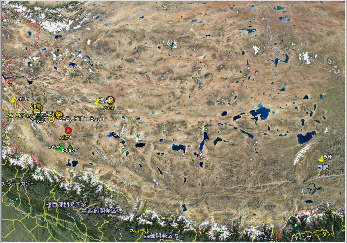
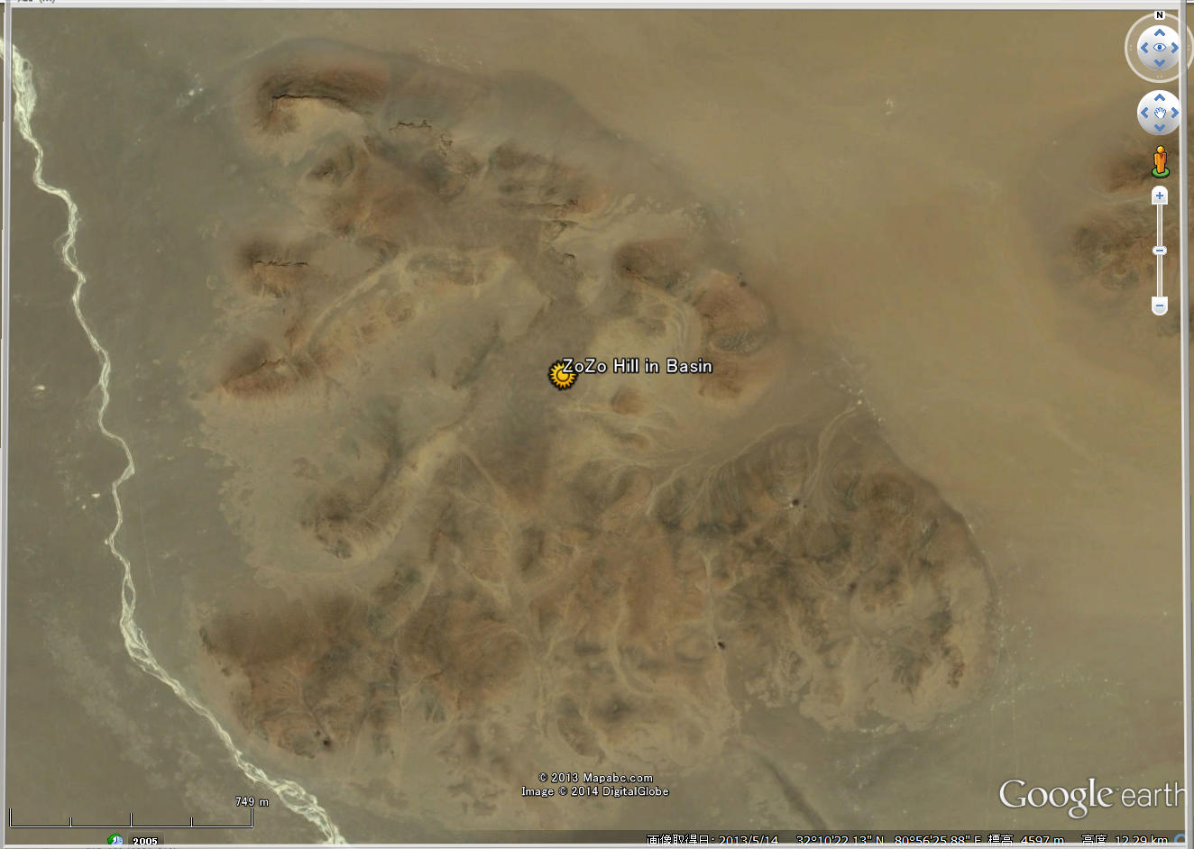
| ZoZo Hill Site Map in west Tibet (Google Earth) |
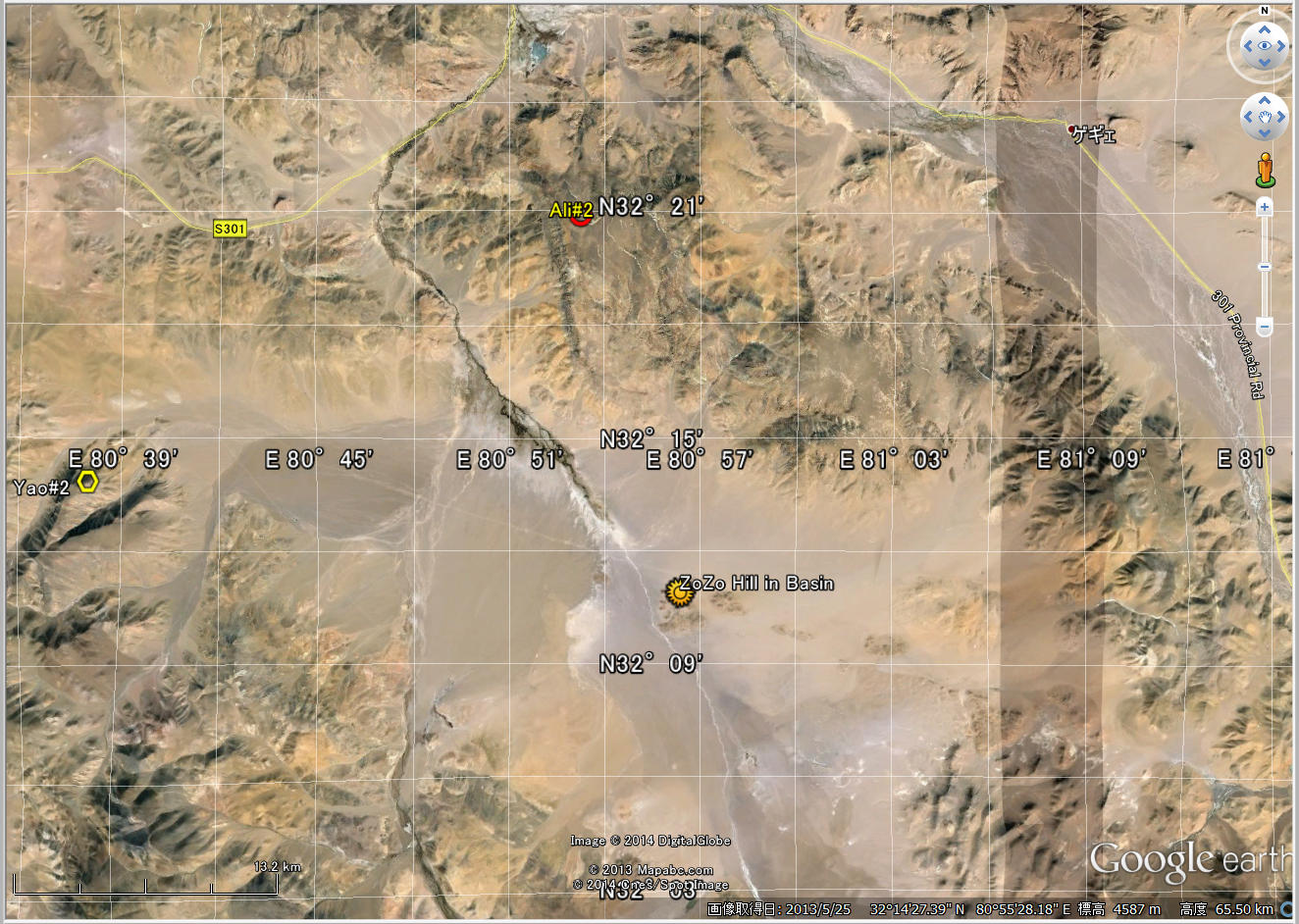
ZoZo Hill Site Map w/ scale of 13km (Google Earth) |
ZoZo Hill GeographicMap w/ scale of 13km and scale resolution of 1km (WRS sim data) presented by 王紅帥さん |
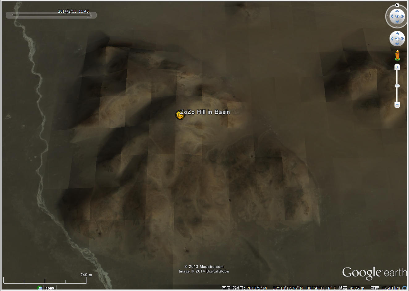
ZoZo Hill Site Map w/ distance scale (Google Earth) |
|
|

|
|
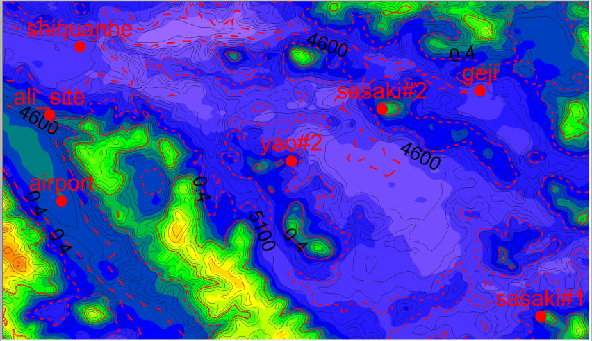
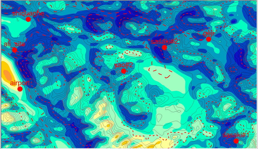
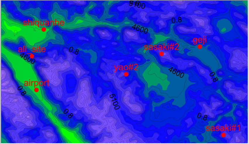
| WRF_CloudCover around ZoZo Hill |
WRF_Seeing around ZoZo Hill |
WRF_Wind_18H_24H around ZoZo Hill |
WRF_PWV around ZoZo Hill |
| --- | |||
|

|
|
|
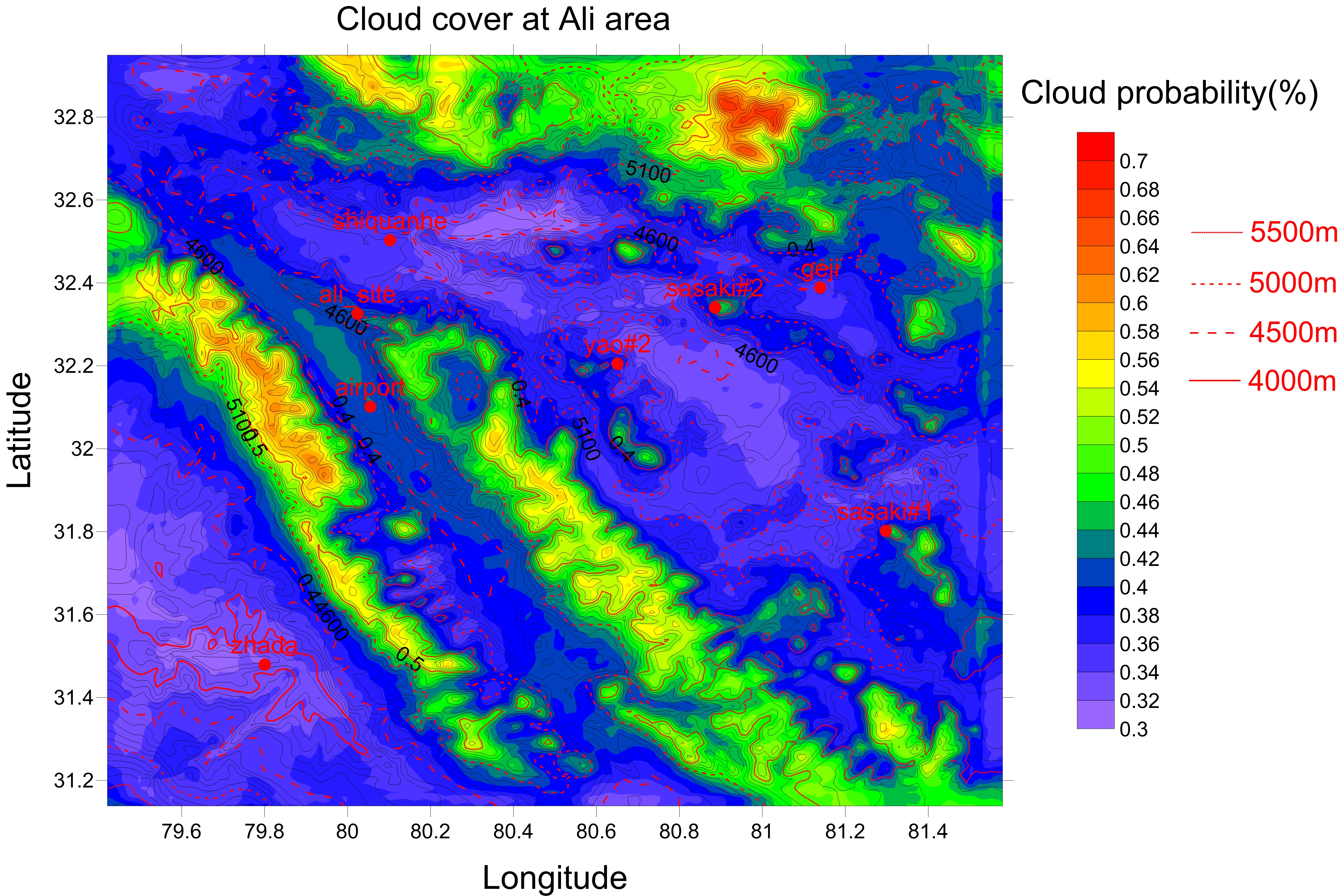
| WRF_CloudCover in Ali area |
WRF_Seeing in Ali area |
WRF_Wind_18H_24H in Ali area |
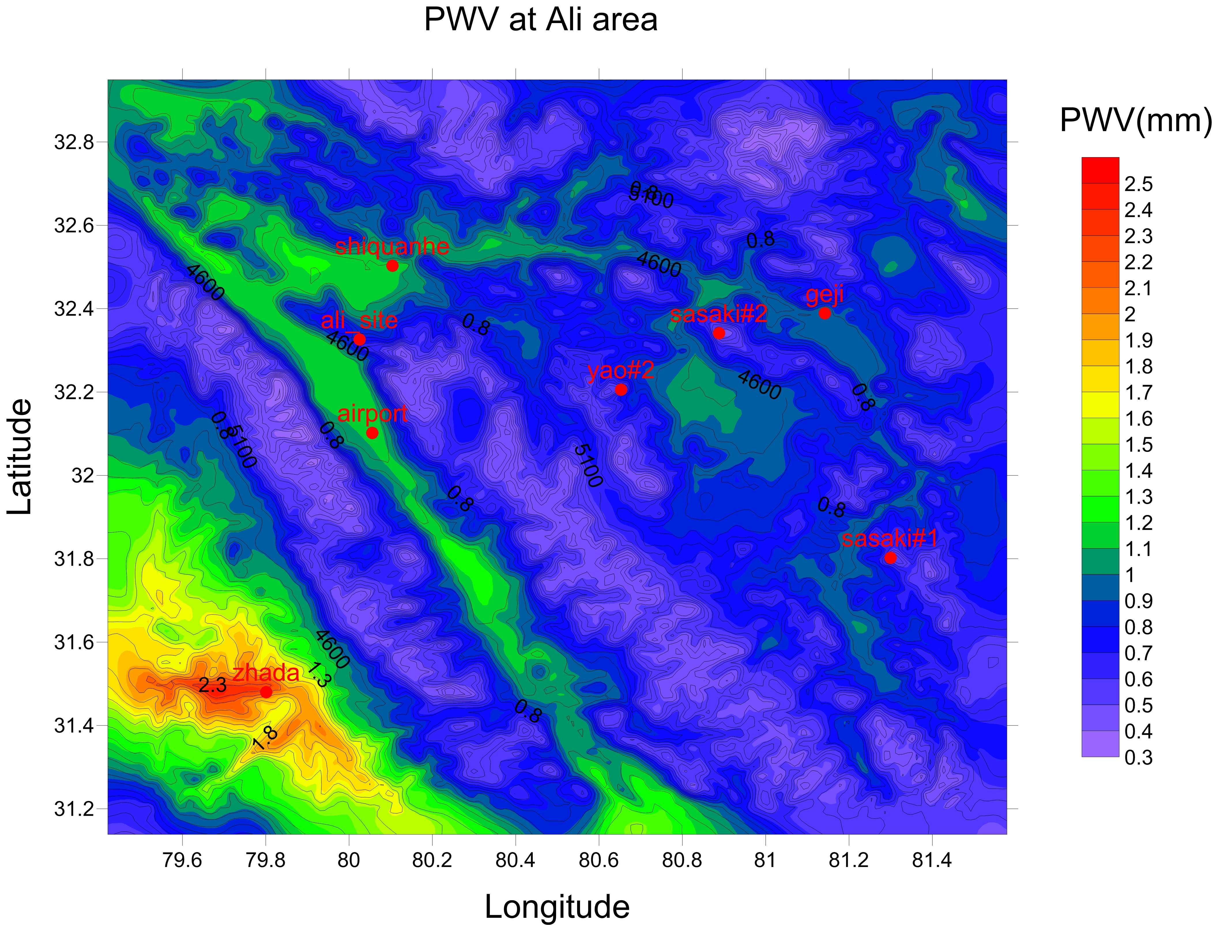
WRF_PWV in Ali area |

|

|

|

|
| ZoZo Hill through Valley |
ZoZo Hill over Left Mountain |
ZoZo Hill over Left Mountain |
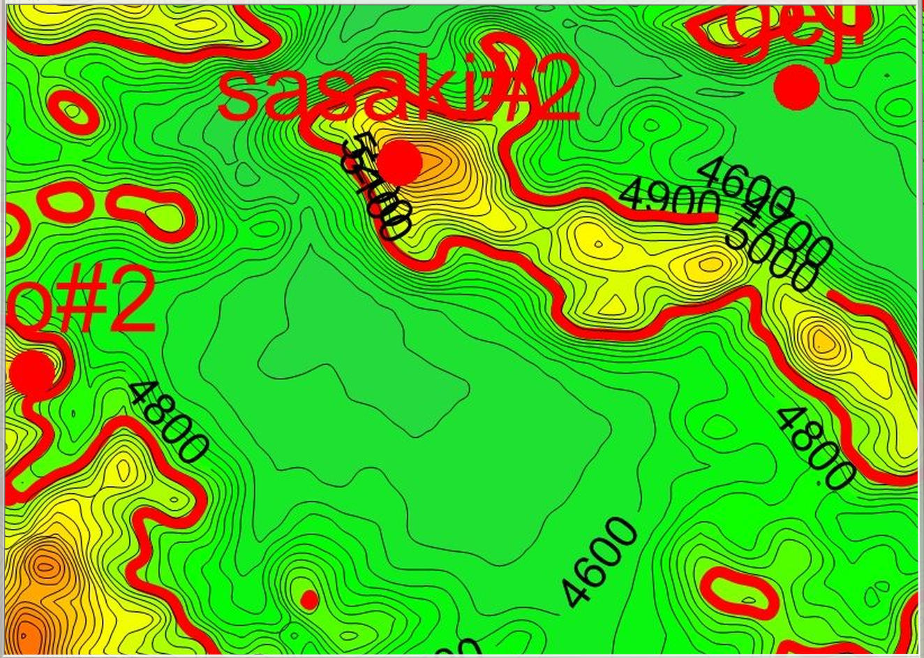
Sasaki-selected candidate Peak#2 |

|

|

|

|
| Traffic Mark to ZoZo village |
Traffic Mark to Shiquanhe (Ali) |
Indus River in Shiquanhe (Ali) |
Hotel in Shiquanhe (Ali) |
|
|
| ZoZo Hill Site Map w/ scale of 749m (Google Earth) |
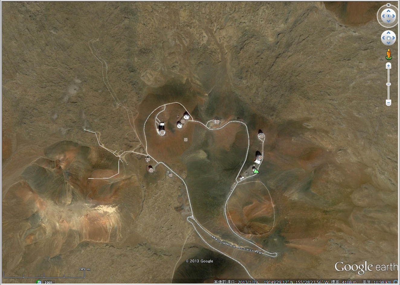
Mouan Kea Summit Map w/ scale of 749m (Google Earth) |